
The National Weather Service issued a Wind Advisory on Friday, Nov. 4, and added that there’s a “slight chance of snow” starting Monday, Nov. 7, 2022.
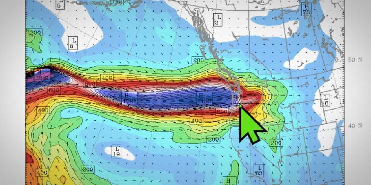
An atmospheric river is aimed at the region, set to dump tons of precipitation as rain in the lowlands, snow in the mountains, along with wind gusts of over 40mph.
 Power was knocked out to 267 Seattle City Light customers in Burien’s Three Tree Point neighborhood Friday morning.
A Flood Watch was also issued.
Normandy Park-based @SeattleWXGuy said in his Friday morning video forecast that we should expect possible power outages after 5 p.m. Friday night, followed by cold air moving in.
“Lots going on here folks,” Snyder said.
Watch Snyder’s full video below:
And here’s a live feed from his weather station in Normandy Park:
Join his channel to help support Pacific Northwest Weather Watch here.
See the latest forecast and Snyder’s latest Tweets on our Weather page here.
46mph! Big gusts rocking the house! #wawx pic.twitter.com/oSj0cpilWQ
— Michael Snyder (@SeattleWXGuy) November 4, 2022
Getting wild out here 39mph, reports of power outages, huge branch down here in Normandy Park #wawx pic.twitter.com/n0IDdkKhBA
— Michael Snyder (@SeattleWXGuy) November 4, 2022
#wawx Wind Advisory would be fully warranted for Puget Sound tomorrow. ECMWF has been showing 40+ mph for most of the area, and some models have 47mph + which starts causing some real problems in the early season. Portland NWS has wind advisory up for lower speeds currently. pic.twitter.com/C1ZSyzP13f
— Michael Snyder (@SeattleWXGuy) November 3, 2022
Blowvember is here #orwx https://t.co/rQpgFowFMX
— Michael Snyder (@SeattleWXGuy) November 4, 2022
Here are the warnings from the National Weather Service:
URGENT – WEATHER MESSAGE
National Weather Service Seattle WA
1051 AM PDT Fri Nov 4 2022
…WIND ADVISORY REMAINS IN EFFECT UNTIL 11 PM PDT THIS EVENING…
* WHAT…South winds 25 to 35 mph with gusts up to 45 mph expected.
* WHERE…Southwest Interior, Tacoma Area, Hood Canal Area, East Puget Sound Lowlands, Bellevue and Vicinity, Seattle and Vicinity and Bremerton and Vicinity.
* WHEN…From 11 AM this morning to 11 PM PDT this evening.
* IMPACTS…Gusty winds could blow around unsecured objects. Tree limbs could be blown down and a few power outages may result.
PRECAUTIONARY/PREPAREDNESS ACTIONS…
Use extra caution when driving, especially if operating a high profile vehicle. Secure outdoor objects.
Flood Watch
National Weather Service Seattle WA
411 AM PDT Fri Nov 4 2022
…FLOOD WATCH REMAINS IN EFFECT THROUGH SATURDAY AFTERNOON…
* WHAT…Flooding caused by excessive rainfall continues to be possible.
* WHERE…Portions of northwest Washington and west central Washington, including the following counties, in northwest Washington, Clallam, Grays Harbor, Jefferson, Skagit and Whatcom. In west central Washington, King, Lewis, Pierce, Snohomish and Thurston.
* WHEN…Through Saturday afternoon.
* IMPACTS…Excessive runoff may result in flooding of rivers, creeks, streams, and other low-lying and flood-prone locations.
* ADDITIONAL DETAILS…
A potent weather system will bring heavy rainfall to the region today through early Saturday. This rainfall will result in rapid rises and potential for flooding along area rivers. http://www.weather.gov/safety/flood
PRECAUTIONARY/PREPAREDNESS ACTIONS…
You should monitor later forecasts and be alert for possible Flood Warnings. Those living in areas prone to flooding should be prepared to take action should flooding develop.
Here’s the detailed 7-day forecast
-
- Friday: Rain. High near 57. Breezy, with a southwest wind 24 to 28 mph, with gusts as high as 43 mph. Chance of precipitation is 100%. New precipitation amounts between a quarter and half of an inch possible.
- Friday Night: Rain likely, mainly before 11pm. Cloudy during the early evening, then becoming partly cloudy, with a low around 42. Breezy, with a southwest wind 21 to 26 mph decreasing to 13 to 18 mph after midnight. Winds could gust as high as 43 mph. Chance of precipitation is 60%. New precipitation amounts of less than a tenth of an inch possible.
- Saturday: Rain likely. Mostly cloudy, with a high near 48. West southwest wind around 15 mph, with gusts as high as 23 mph. Chance of precipitation is 70%. New precipitation amounts of less than a tenth of an inch possible.
- Saturday Night: Rain. Low around 38. South wind around 14 mph, with gusts as high as 22 mph. Chance of precipitation is 100%. New precipitation amounts between a quarter and half of an inch possible.
- Sunday: Rain. High near 44. South wind 5 to 11 mph. Chance of precipitation is 90%. New precipitation amounts between a tenth and quarter of an inch possible.
- Sunday Night: Rain likely, mainly before 11pm. Mostly cloudy, with a low around 33. Chance of precipitation is 70%. New precipitation amounts of less than a tenth of an inch possible.
- Monday: Rain likely before 8am, then rain and snow likely between 8am and 2pm, then a chance of rain after 2pm. Mostly cloudy, with a high near 42. Chance of precipitation is 60%. Little or no snow accumulation expected.
- Monday Night: A chance of rain and snow before 11pm. Mostly cloudy, with a low around 31.
- Tuesday: A slight chance of snow before 2pm, then a slight chance of rain and snow. Partly sunny, with a high near 40.
- Tuesday Night: A slight chance of rain and snow before 11pm, then a slight chance of snow. Mostly cloudy, with a low around 29.
- Wednesday: Mostly sunny, with a high near 40.
- Wednesday Night: A slight chance of snow. Partly cloudy, with a low around 30.
- Thursday: A chance of rain and snow. Partly sunny, with a high near 42.
Recent Comments